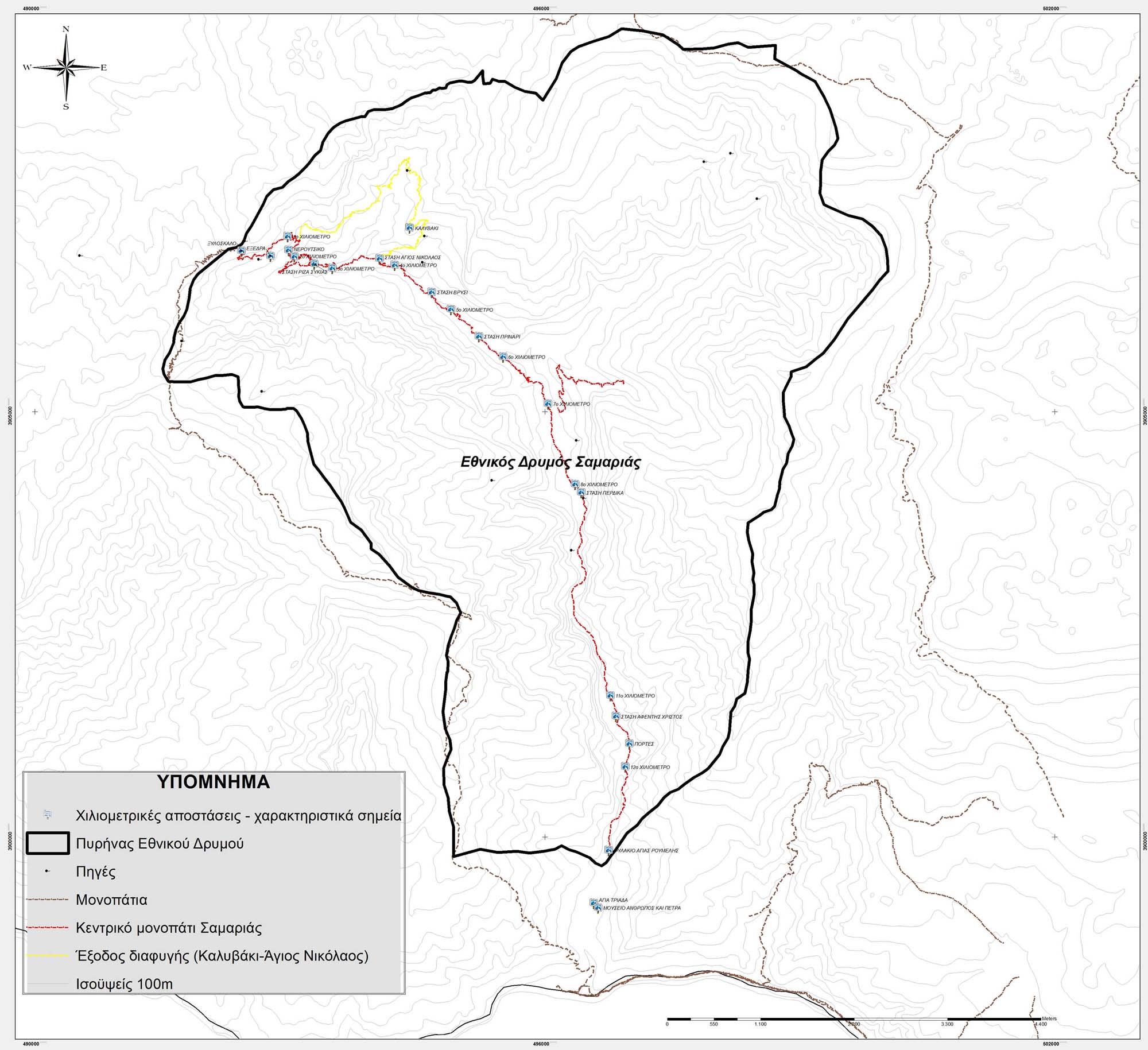
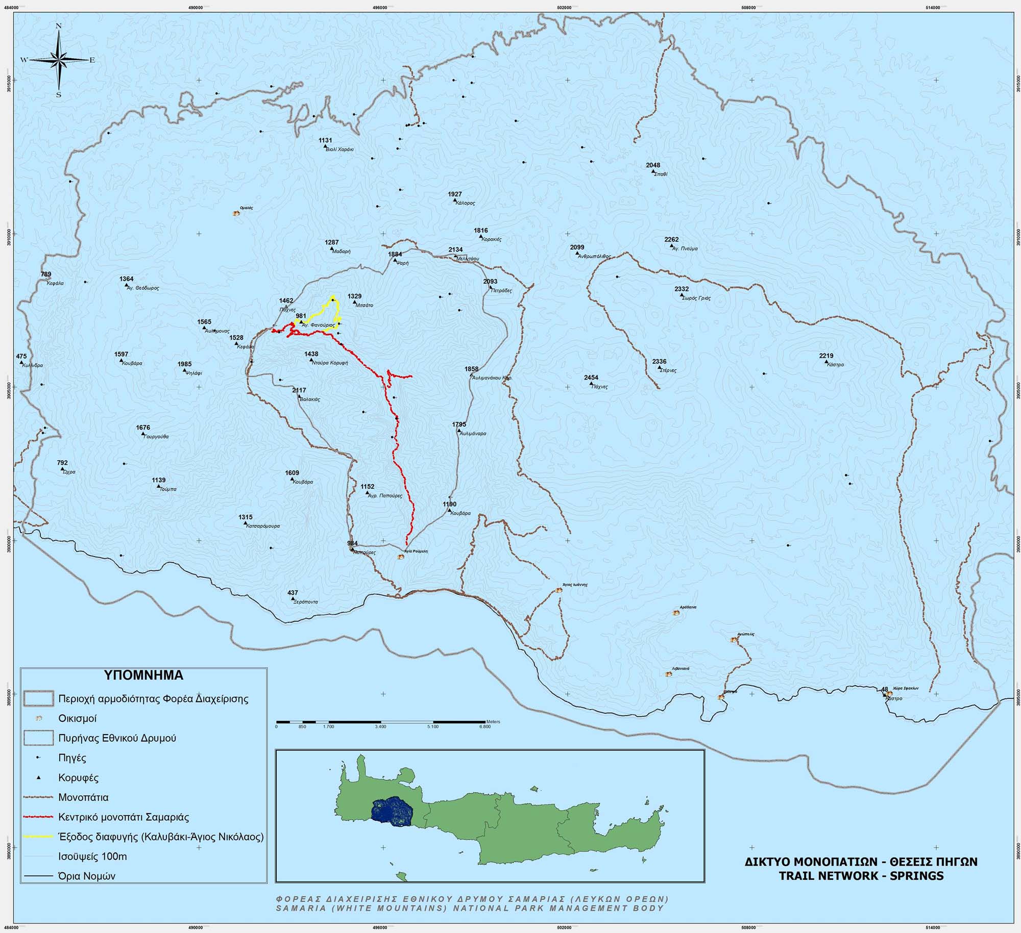
O Φορέας Διαχείρισης Εθνικού Δρυμού Σαμαριάς -Δυτικής Κρήτης ενσωματώθηκε στον Οργανισμό Φυσικού Περιβάλλοντος και Κλιματικής Αλλαγής (Ο.ΦΥ.ΠΕ.Κ.Α.) σύμφωνα με την υπ’ αριθμ. ΥΠΕΝ/ΔΝΕΠ/9964/419/3-2-2022 απόφαση (ΦΕΚ 965/Β/3-3-2022)
Η ιστοσελίδα της νέας Μονάδας Διαχείρισης Εθνικού Πάρκου Σαμαριάς και Προστατευόμενων Περιοχών Δυτικής Κρήτης είναι διαθέσιμη στον ακόλουθο σύνδεσμο:
https://necca.gov.gr/mu-samaria
Για πληροφορίες που αφορούν τον Εθνικό Δρυμό (π.χ., έκτακτες ενημερώσεις, ωράριο λειτουργίας, κατηγορίες εισιτηρίων, την διαδρομή, την ασφάλεια, κ.λπ.) καθώς και για την έκδοση ηλεκτρονικών εισιτηρίων, παρακαλούμε να επισκέπτεστε την ιστοσελίδα:
https://samaria-tickets.necca.gov.gr/checkout
Η παρούσα ιστοσελίδα του πρώην Φορέα (https://www.samaria.gr) πλέον δεν ενημερώνεται και παραμένει για αρχειακούς λόγους.
Επικοινωνία: mdpp.samaria@necca.gov.gr
Natural Environment and Climate Change Agency (NECCA) incorporated Samaria National Park Management Body, due to MD ΥΠΕΝ/ΔΝΕΠ/9964/419/3-2-2022 (GG 965/Β/3-3-2022)
The website of Management Unit of Samaria National Park and the Protected Areas of Western Crete is available at the following url:
https://necca.gov.gr/mu-samaria
For information regarding the National Park (eg, emergency notices, opening hours, ticket categories, the route, safety, etc.) as well as for the issuance of e-tickets, please visit the website:
https://samaria-tickets.necca.gov.gr/checkout
The present website of the ex-Management Body (https://www.samaria.gr) is not currently updated and remains live for archival purposes.
Contact: mdpp.samaria@necca.gov.gr